The Jan11th Static Quiz on Geography (Coastal, Arid and Karst Landforms)
Quiz-summary
0 of 10 questions completed
Questions:
- 1
- 2
- 3
- 4
- 5
- 6
- 7
- 8
- 9
- 10
Information
The Jan11th Static Quiz on Geography (Coastal, Arid and Karst Landforms)
You have already completed the quiz before. Hence you can not start it again.
Quiz is loading...
You must sign in or sign up to start the quiz.
You have to finish following quiz, to start this quiz:
Results
0 of 10 questions answered correctly
Your time:
Time has elapsed
You have reached 0 of 0 points, (0)
Categories
- Not categorized 0%
- 1
- 2
- 3
- 4
- 5
- 6
- 7
- 8
- 9
- 10
- Answered
- Review
- Question 1 of 10
1. Question
Which of the following statements about Karst Landforms are correct?
1. Karst is a landscape which is underlain by limestone which has been eroded by dissolution, producing towers, fissures, sinkholes, etc.
2. It is so named after a province of Yugoslavia on the black sea coast where such formations are most noticeable.CorrectAns;- a) Only 1
Explanation;-
• The 2nd statement is incorrect because it is on Adriatic Sea
About Karst Landforms
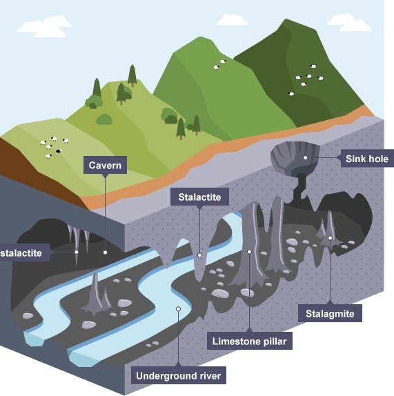
• Karst is a topography formed from the dissolution of soluble rocks such as limestone, dolomite, and gypsum.
• It is characterized by underground drainage systems with sinkholes and caves.
• Karst is a landscape which is underlain by limestone which has been eroded by dissolution, producing towers, fissures, sinkholes, etc.
• It is so named after a province of Yugoslavia on the Adriatic sea coast where such formations are most noticeable.
• Karst topography is a landscape formed from the dissolution of soluble rocks such as limestone, dolomite, and gypsum.
• It is characterized by underground drainage systems with sinkholes, caves etc..
• Presence of soluble rocks, preferably limestone at the surface or sub-surface level.
• These rocks should be dense, highly jointed and thinly bedded.
• Presence of soluble rocks, preferably limestone at the surface or sub-surface level.
• These rocks should be dense, highly jointed and thinly bedded.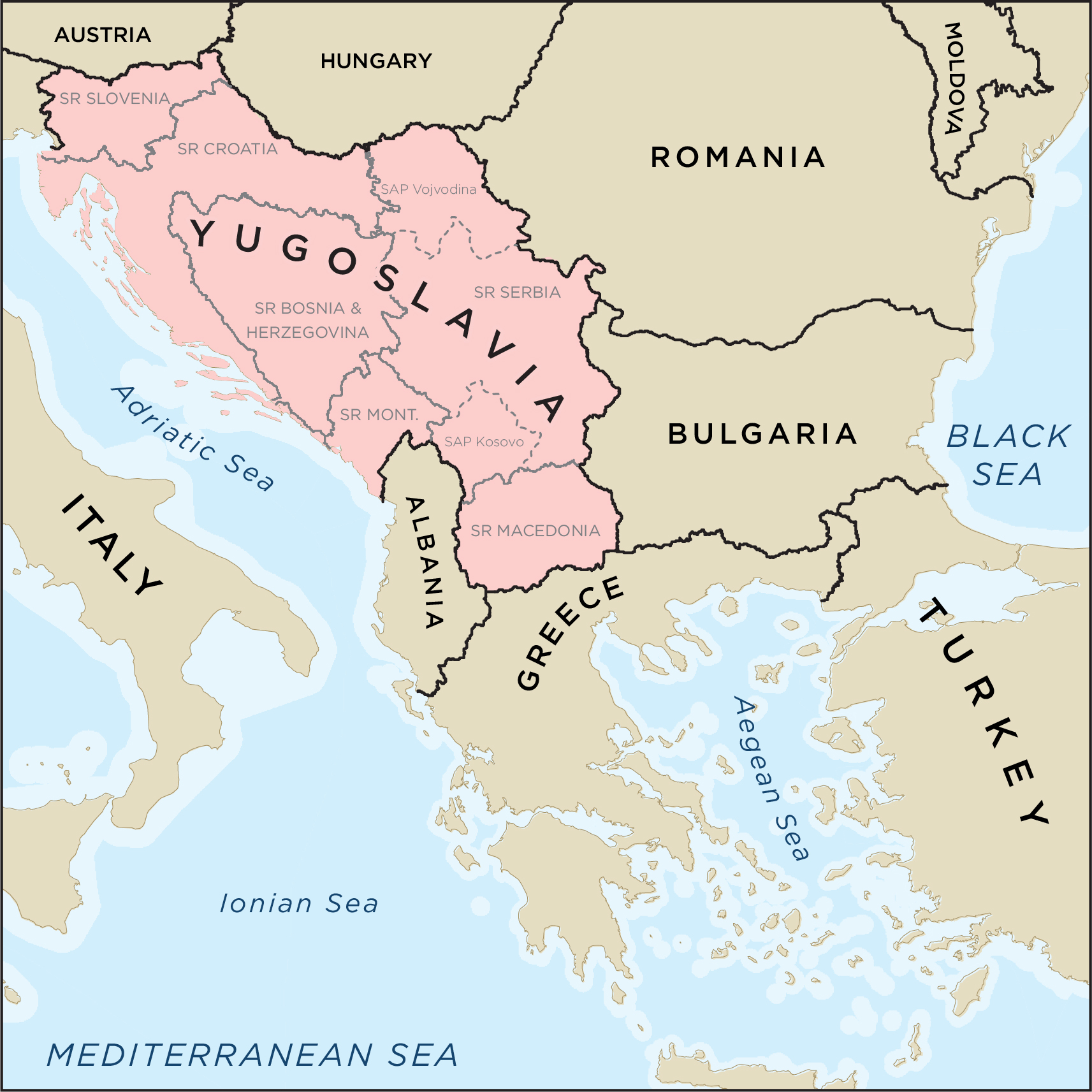 Incorrect
Ans;- a) Only 1
Explanation;-
• The 2nd statement is incorrect because it is on Adriatic Sea
About Karst Landforms
• Karst is a topography formed from the dissolution of soluble rocks such as limestone, dolomite, and gypsum.
• It is characterized by underground drainage systems with sinkholes and caves.
• Karst is a landscape which is underlain by limestone which has been eroded by dissolution, producing towers, fissures, sinkholes, etc.
• It is so named after a province of Yugoslavia on the Adriatic sea coast where such formations are most noticeable.
• Karst topography is a landscape formed from the dissolution of soluble rocks such as limestone, dolomite, and gypsum.
• It is characterized by underground drainage systems with sinkholes, caves etc..
• Presence of soluble rocks, preferably limestone at the surface or sub-surface level.
• These rocks should be dense, highly jointed and thinly bedded.
• Presence of soluble rocks, preferably limestone at the surface or sub-surface level.
• These rocks should be dense, highly jointed and thinly bedded.
- Question 2 of 10
2. Question
Which of the following statements are correctly matched?
1. Stalagmite = is an icicle-shaped formation that hangs from the ceiling of a cave and is produced by precipitation of minerals from water dripping through the cave ceiling.
2. Stalactite = is an upward-growing mound of mineral deposits that have precipitated from water dripping onto the floor of a cave.CorrectAns;- d) None of the above
Explanation;-
• Both the are incorrectly matched because both are reversed.
• A stalagmite is an upward-growing mound of mineral deposits that have precipitated from water dripping onto the floor of a cave. Most stalagmites have rounded or flattened tips. There are many other types of mineral formations found in caves.
• A stalactite is an icicle-shaped formation that hangs from the ceiling of a cave and is produced by precipitation of minerals from water dripping through the cave ceiling. Incorrect
Ans;- d) None of the above
Explanation;-
• Both the are incorrectly matched because both are reversed.
• A stalagmite is an upward-growing mound of mineral deposits that have precipitated from water dripping onto the floor of a cave. Most stalagmites have rounded or flattened tips. There are many other types of mineral formations found in caves.
• A stalactite is an icicle-shaped formation that hangs from the ceiling of a cave and is produced by precipitation of minerals from water dripping through the cave ceiling.
- Question 3 of 10
3. Question
Which of the following are the Conditions Essential for Full Development of Karst Topography ?
1. Presence of soluble rocks, preferably limestone at the surface or sub-surface level.
2. These rocks should be dense, highly loose and thinly bedded.CorrectAns;- a) Only 1
Explanation;-
• The 2nd statement is incorrect because These rocks should be dense, highly jointed and thinly bedded, not highly loose.
Conditions Essential for Full Development of Karst Topography
a. Presence of soluble rocks, preferably limestone at the surface or sub-surface level.
b. These rocks should be dense, highly jointed and thinly bedded.
c. Relatively thick massive soluble rock, i.e., limestone, dolomite, or chalk.
d. Carbonate rocks should be very close to the ground surface.
e. Lime stones should not be porous.
f. Limestone should be highly folded, faulted or fractured.
g. Marked development of joints. If the rock is bedded, the beds should be thin.
h. Considerable relief so that water is capable of circulation to cause typical karst topography.
i. Moderate to heavy rainfall to cause solution of rocks.IncorrectAns;- a) Only 1
Explanation;-
• The 2nd statement is incorrect because These rocks should be dense, highly jointed and thinly bedded, not highly loose.
Conditions Essential for Full Development of Karst Topography
a. Presence of soluble rocks, preferably limestone at the surface or sub-surface level.
b. These rocks should be dense, highly jointed and thinly bedded.
c. Relatively thick massive soluble rock, i.e., limestone, dolomite, or chalk.
d. Carbonate rocks should be very close to the ground surface.
e. Lime stones should not be porous.
f. Limestone should be highly folded, faulted or fractured.
g. Marked development of joints. If the rock is bedded, the beds should be thin.
h. Considerable relief so that water is capable of circulation to cause typical karst topography.
i. Moderate to heavy rainfall to cause solution of rocks. - Question 4 of 10
4. Question
Which of the following are the importance of Karst Topography?
1. Caves are large enough survival of animals, forest dwellers.
2. The karstified limestone acts as aquifers it contain huge amount of water, which can used during dry months.CorrectAns;- c) Both 1 and 2
Explanation;-
• Both the statements are correct.
Importance of Karst topography
• Karst is a special type of landscape that is formed by the dissolution of soluble rocks, including limestone and dolomite. Karst regions contain aquifers that are capable of providing large supplies of water. More than 25 percent of the world’s population either lives on or obtains its water from karst aquifers.
• Caves are large enough survival of animals, forest dwellers.
• The karstified limestone acts as aquifers it contain huge amount of water, which can used during dry months.
• Example: Two million people in central Texas get their drinking water from the karst aquifer known as the Edwards Aquifer.
• Caves, sinkholes, underground streams karst landforms can be spectacular and support unique ecosystems, which is why they need protection.
• New South Wales (NSW) karst environments are among the oldest and most complex in the world, giving them outstanding national and international importance.IncorrectAns;- c) Both 1 and 2
Explanation;-
• Both the statements are correct.
Importance of Karst topography
• Karst is a special type of landscape that is formed by the dissolution of soluble rocks, including limestone and dolomite. Karst regions contain aquifers that are capable of providing large supplies of water. More than 25 percent of the world’s population either lives on or obtains its water from karst aquifers.
• Caves are large enough survival of animals, forest dwellers.
• The karstified limestone acts as aquifers it contain huge amount of water, which can used during dry months.
• Example: Two million people in central Texas get their drinking water from the karst aquifer known as the Edwards Aquifer.
• Caves, sinkholes, underground streams karst landforms can be spectacular and support unique ecosystems, which is why they need protection.
• New South Wales (NSW) karst environments are among the oldest and most complex in the world, giving them outstanding national and international importance. - Question 5 of 10
5. Question
Which of the following are the Erosional Arid Landforms?
1. Ravine
2. Badland Topography
3. RillCorrectAns;- d) All of the above
Explanation;-
• All are erosional arid landforms
Erosional Arid Landforms
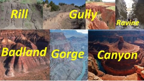
• Rill
In hill slope geomorphology, a rill is a narrow and shallow channel cut into soil by the erosive action of flowing water.
• Gully
A gully is a landform created by running water. Gullies resemble large ditches or small valleys, but are metres to tens of metres in depth and width.
• Ravine
A ravine is a landform narrower than a canyon and is often the product of stream cutting erosion. Ravines are typically classified as larger in scale than gullies, although smaller than valleys.
• Badland Topography
In arid regions occasional rainstorms produce numerous rills and channels which extensively erode weak sedimentary formations.
Ravines and gullies are developed by linear fluvial erosion leading to the formation of badland topography.
Example: Chambal Ravines. Incorrect
Ans;- d) All of the above
Explanation;-
• All are erosional arid landforms
Erosional Arid Landforms
• Rill
In hill slope geomorphology, a rill is a narrow and shallow channel cut into soil by the erosive action of flowing water.
• Gully
A gully is a landform created by running water. Gullies resemble large ditches or small valleys, but are metres to tens of metres in depth and width.
• Ravine
A ravine is a landform narrower than a canyon and is often the product of stream cutting erosion. Ravines are typically classified as larger in scale than gullies, although smaller than valleys.
• Badland Topography
In arid regions occasional rainstorms produce numerous rills and channels which extensively erode weak sedimentary formations.
Ravines and gullies are developed by linear fluvial erosion leading to the formation of badland topography.
Example: Chambal Ravines.
- Question 6 of 10
6. Question
Which of the following statements about Butte and Mesa are correct?
1. Mesa = is an isolated hill with steep, often vertical sides and a small, relatively flat top
2. Butte = is a flat-topped mountain or hill.CorrectAns;- d) None of the above
Explanation;-
• Both are incorrect because both are reversed.
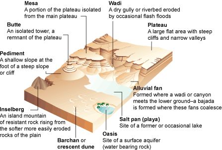
• A mesa is a flat-topped mountain or hill. It is a wide, flat, elevated landform with steep sides. Mesa is a Spanish word that means table. Spanish explorers of the American southwest, where many mesas are found, used the word because the tops of mesas look like the tops of tables.
In geomorphology, a butte is an isolated hill with steep, often vertical sides and a small, relatively flat top; buttes are smaller landforms than mesas, plateaus, and tablelands. Incorrect
Ans;- d) None of the above
Explanation;-
• Both are incorrect because both are reversed.
• A mesa is a flat-topped mountain or hill. It is a wide, flat, elevated landform with steep sides. Mesa is a Spanish word that means table. Spanish explorers of the American southwest, where many mesas are found, used the word because the tops of mesas look like the tops of tables.
In geomorphology, a butte is an isolated hill with steep, often vertical sides and a small, relatively flat top; buttes are smaller landforms than mesas, plateaus, and tablelands.
- Question 7 of 10
7. Question
Which of the following statemensts about Inselberg are correct?
1. Inselbergs are generally erosional remnants.
2. Often, inselbergs are composed of harder metamorphic rock (such as granite) that is more resistant to erosion.CorrectAns;- a) Only 1
Explanation;-
• The 2nd statement is wrong because Often, inselbergs are composed of harder igneous rock (such as granite) that is more resistant to erosion not igneous.
• An inselberg or monadnock is an isolated rock hill, knob, ridge, or small mountain that rises abruptly from a gently sloping or virtually level surrounding plain. In Southern Africa a similar formation of granite is known as a koppie, an Afrikaans word from the Dutch diminutive word kopje.
• Inselbergs are generally erosional remnants. Often, inselbergs are composed of harder igneous rock (such as granite) that is more resistant to erosion. However, inselbergs may also form in sedimentary rocks.
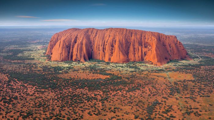
• Uluru or Ayer’s Rock inselberg in Australia Incorrect
Ans;- a) Only 1
Explanation;-
• The 2nd statement is wrong because Often, inselbergs are composed of harder igneous rock (such as granite) that is more resistant to erosion not igneous.
• An inselberg or monadnock is an isolated rock hill, knob, ridge, or small mountain that rises abruptly from a gently sloping or virtually level surrounding plain. In Southern Africa a similar formation of granite is known as a koppie, an Afrikaans word from the Dutch diminutive word kopje.
• Inselbergs are generally erosional remnants. Often, inselbergs are composed of harder igneous rock (such as granite) that is more resistant to erosion. However, inselbergs may also form in sedimentary rocks.
• Uluru or Ayer’s Rock inselberg in Australia
- Question 8 of 10
8. Question
Which of the following are the Arid Depositional Landforms?
1. Ripple Marks
2. Sand dunes
3. Mushroom rocksCorrectAns;- a) Only 1 and 2
Explanation;-
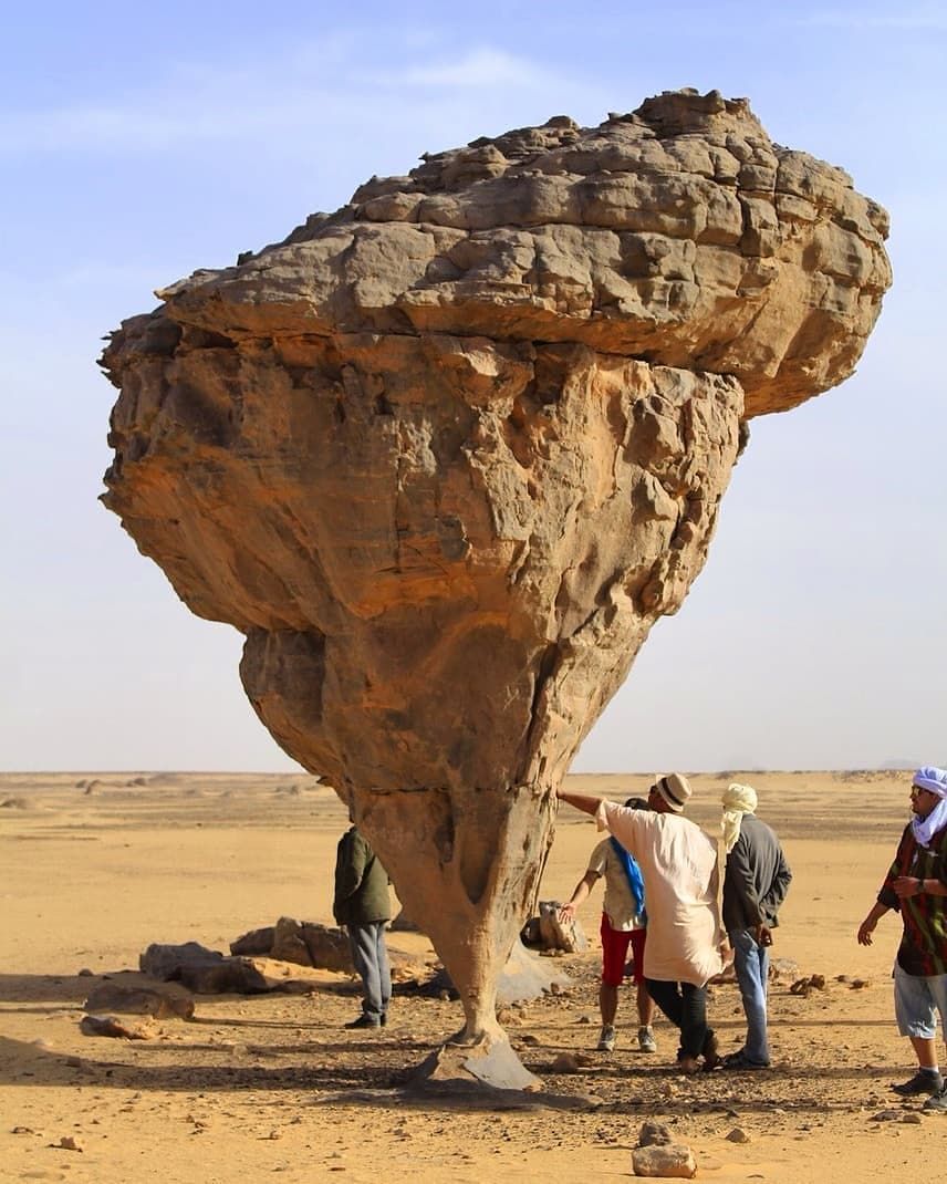
• The mushroom rocks are not arid depositional landforms it is erosional
• A mushroom rock, also called rock pedestal or a pedestal rock, is a naturally occurring rock whose shape, as its name implies, resembles a mushroom.
• The rocks are deformed in a number of different ways: by erosion and weathering, glacial action, or from a sudden disturbance. Mushroom rocks are related to, but different from, yardang.
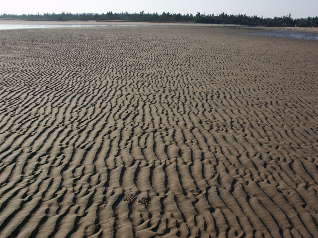
• Ripple marks are sedimentary structures and indicate agitation by water (current or waves) or wind. Ripple marks are ridges of sediment that form in response to wind blowing along a layer of sediment

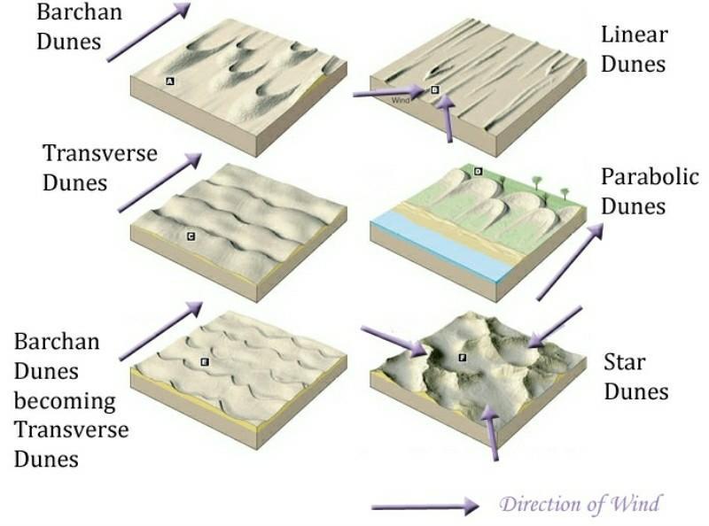
• Sand dunes are heaps or mounds of sand found in deserts. Generally their heights vary from a few metres to 20 metres but in some cases dunes are several hundred metres high and 5 to 6 km long.
 Incorrect
Ans;- a) Only 1 and 2
Explanation;-
• The mushroom rocks are not arid depositional landforms it is erosional
• A mushroom rock, also called rock pedestal or a pedestal rock, is a naturally occurring rock whose shape, as its name implies, resembles a mushroom.
• The rocks are deformed in a number of different ways: by erosion and weathering, glacial action, or from a sudden disturbance. Mushroom rocks are related to, but different from, yardang.
• Ripple marks are sedimentary structures and indicate agitation by water (current or waves) or wind. Ripple marks are ridges of sediment that form in response to wind blowing along a layer of sediment

• Sand dunes are heaps or mounds of sand found in deserts. Generally their heights vary from a few metres to 20 metres but in some cases dunes are several hundred metres high and 5 to 6 km long.

- Question 9 of 10
9. Question
Which of the following are the Marine Erosional Landforms?
1. Chasms
2. Sea Arches
3. Sea CavesCorrectAns;- d) All of the above
Explanation;-
• All are correct and part of marine erosional landforms
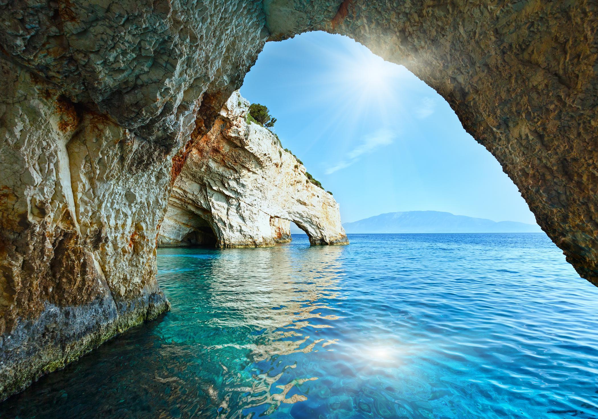
• A sea cave, also known as a littoral cave, is a type of cave formed primarily by the wave action of the sea. The primary process involved is erosion. Sea caves are found throughout the world, actively forming along present coastlines and as relict sea caves on former coastlines.

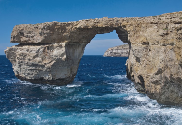
• Sea arches are a spectacular phenomena created by Mother Nature with a little help from oceans. They are usually composed of a soft rock that eroded over millions of years as waves hit land, carving caves and tunnels in the rock.

Chasma
• These are narrow, deep indentations (a deep recess or notch on the edge or surface of something) carved due to headward erosion (downcutting) through vertical planes of weakness in the rocks by wave action.
• With time, further headward erosion is hindered by lateral erosion of chasm mouth, which itself keeps widening till a bay is formed. Incorrect
Ans;- d) All of the above
Explanation;-
• All are correct and part of marine erosional landforms
• A sea cave, also known as a littoral cave, is a type of cave formed primarily by the wave action of the sea. The primary process involved is erosion. Sea caves are found throughout the world, actively forming along present coastlines and as relict sea caves on former coastlines.

• Sea arches are a spectacular phenomena created by Mother Nature with a little help from oceans. They are usually composed of a soft rock that eroded over millions of years as waves hit land, carving caves and tunnels in the rock.

Chasma
• These are narrow, deep indentations (a deep recess or notch on the edge or surface of something) carved due to headward erosion (downcutting) through vertical planes of weakness in the rocks by wave action.
• With time, further headward erosion is hindered by lateral erosion of chasm mouth, which itself keeps widening till a bay is formed.
- Question 10 of 10
10. Question
Which of the following are the Marine depositional Landforms?
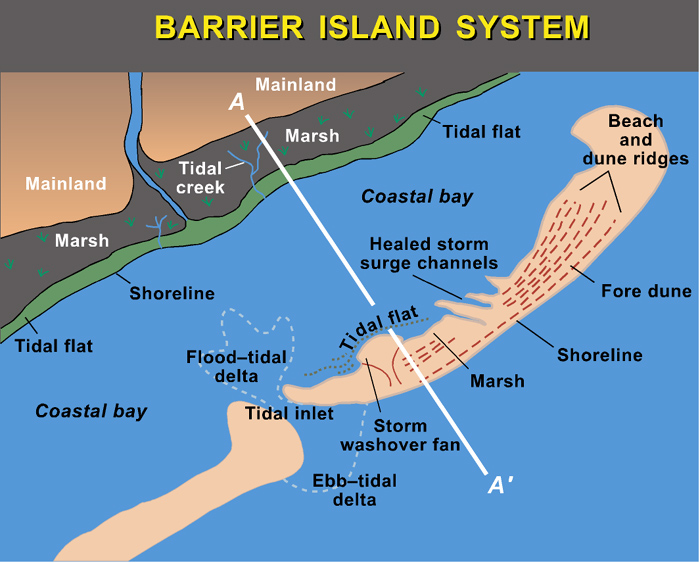
1. Barrier
2. Beaches
3. TombolosCorrectAns;- d) All of the above
Explanation;-
• All are marine depositional landforms
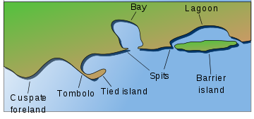
• A tombolo is a sandy isthmus. A tombolo, from the Italian tombolo, meaning ‘pillow’ or ‘cushion’, and sometimes translated as ayre, is a deposition landform in which an island is attached to the mainland by a narrow piece of land such as a spit or bar. Once attached, the island is then known as a tied island.

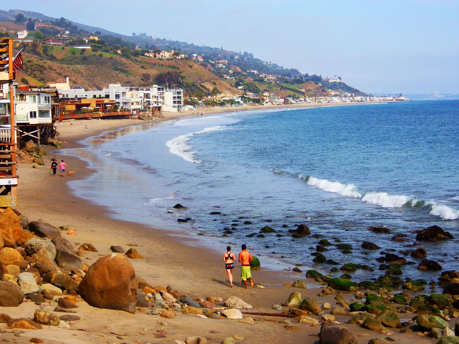
• Beaches are features of deposition found in coastal areas between high and low tide. They are generally found in areas where there is an inlet or sheltered area, between headlands or a change in the coastline which causes sediment to be trapped and build up.
• Beaches are areas of sand, shingle and larger stones.
• A geographical barrier can be a mountain range, a large canyon, a body of water, or large expanses of climatic differences (e.g., a desert). Allopatric speciation is a mechanism of speciation that is initiated by the physical separation of one population into two or more physically isolated population.
 Incorrect
Ans;- d) All of the above
Explanation;-
• All are marine depositional landforms
• A tombolo is a sandy isthmus. A tombolo, from the Italian tombolo, meaning ‘pillow’ or ‘cushion’, and sometimes translated as ayre, is a deposition landform in which an island is attached to the mainland by a narrow piece of land such as a spit or bar. Once attached, the island is then known as a tied island.

• Beaches are features of deposition found in coastal areas between high and low tide. They are generally found in areas where there is an inlet or sheltered area, between headlands or a change in the coastline which causes sediment to be trapped and build up.
• Beaches are areas of sand, shingle and larger stones.
• A geographical barrier can be a mountain range, a large canyon, a body of water, or large expanses of climatic differences (e.g., a desert). Allopatric speciation is a mechanism of speciation that is initiated by the physical separation of one population into two or more physically isolated population.


