Why in news?
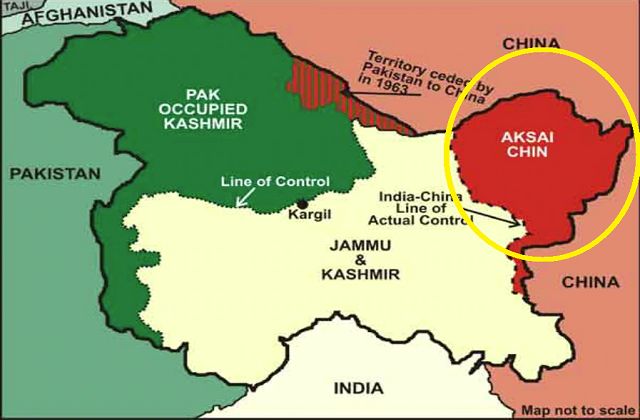
Amid heightened confrontation in east Ladakh, Chinese state media claimed that India has built illegal defence facilities at Galwan Valley in the Aksai China region quoting anonymous military sources.
Recent Events: Pinpricks
- Indian and Chinese forces clashing along the northern bank of the Pangong Tso Lake earlier in May 2020.
- India has imposed higher levels of scrutiny on Chinese investments which was disapproved by China.
- Nepal’s objection to a road inaugurated at Lipulekh pass, (and Army chief Gen. M M Naravane hinting that Nepal may have acted at China’s instance).
India’s Response to the Small Conflicts
- The Indian government said that the border had remained largely peaceful in keeping with the spirit of the recent Modi-Xi informal summits and that the situations that had arisen “occasionally” on the ground could have been avoided if the two sides had a common perception of the LAC.
- The MEA had said the two sides had established mechanisms to resolve such situations as and when they arise and that India remained committed to the objective of maintaining peace and tranquility in the border areas.
Aksai Chin

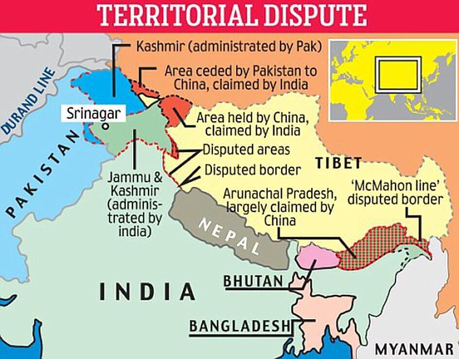
- Aksai Chin is a region administered by China as part of its Xinjiang and Tibet autonomous regions, claimed by India as part of the union territory of Ladakh and constituting the eastern portion of the larger Kashmir region which has been the subject of a dispute since 1962.
- The line that separates Indian-administered areas of Ladakh from Aksai Chin is known as the Line of Actual Control (LAC) and is concurrent with the Chinese Aksai Chin claim line.
- The area is largely a vast high-altitude desert with number of endorheic basins with many salt or soda lakes.
- Because of its 5,000 metre (16,000 ft) elevation, the desolation of Aksai Chin meant that it had no human importance other than as an ancient trade route, which provided a temporary pass during summer for caravans of yaks between Xinjiang and Tibet.
- Despite this region being nearly uninhabitable and having no resources, it remains strategically important for China as it connects Tibet and Xinjiang.
- For military campaigns, the region held great importance, as it was on the only route from Tarim Basin to Tibet that was passable all year round.
History of the Line between India and China:
- William Johnson, a civil servant with the Survey of India proposed the “Johnson Line” in 1865, which put Aksai Chin in Kashmir. This was the time of the Dungan revolt, when China did not control most of Xinjiang, so this line was never presented to the Chinese.
- The Macartney–Macdonald Line: In 1899, Britain proposed a revised boundary, initially suggested by Macartney. This boundary placed the Lingzi Tang plains, which are south of the Laktsang range, in India, and Aksai Chin proper, which is north of the Laktsang range, in China.
- Upon independence in 1947, the government of India used the Johnson Line as the basis for its official boundary in the west, which included the Aksai Chin.
- On 1 July 1954 Prime Minister Jawaharlal Nehru wrote a memo directing that the maps of India be revised to show definite boundaries on all frontiers. Up to this point, the boundary in the Aksai Chin sector, based on the Johnson Line, had been described as “undemarcated.”
- India’s position was that the Aksai Chin was “part of the Ladakh region of India for centuries” and that this northern border was a “firm and definite one which was not open to discussion with anybody”.
- The 1962 India-China War: During the 1950s, the People’s Republic of China built a 1,200 km (750 mi) road connecting Xinjiang and western Tibet, of which 179 km (112 mi) ran south of the Johnson Line through the Aksai Chin region claimed by India. Construction started in 1951 and the road was completed in 1957. The Indians did not learn of the existence of the road until 1957. The construction of this highway was one of the triggers for the Sino-Indian War of 1962.

-Source: Times of India


